World Ocean Atlas 2018 (WOA18)
World Ocean Atlas 2018 (WOA18)
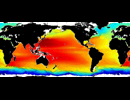
World Ocean Atlas 2018 (WOA18) is a set of 0.25x0.25 degree, 1x1 degree, and 5x5 degree climatological fields of in situ temperature and salinity at standard depth levels for annual, seasonal, and monthly compositing periods (1955-2017 (average decades ), 1981-2000 (average decades 1981-2000), 1955-1964, 1965-1974, 1975-1984, 1985-1994, 1995-2004, 2005-2017) for the World Ocean. The 1x1 degree and 5x5 degree also includes other variables such as apparent oxygen utilization, dissolved oxygen, nitrate, percent oxygen saturation, phosphate, and silicate. The climatological fields also includes It includes objectively analyzed, statistical means, and associated statistical fields of observed oceanographic profile data interpolated to standard depth levels.
References for each variable are here.
For example temperature's publication is:
Locarnini, R. A., A. V. Mishonov, O. K. Baranova, T. P. Boyer, M. M. Zweng, H. E. Garcia, J. R. Reagan, D. Seidov, K. W. Weathers, C. R. Paver, I. V. Smolyar, 2019: World Ocean Atlas 2018, Volume 1: Temperature. A. V. Mishonov, Technical Ed., NOAA Atlas NESDIS 81.
These data are openly available to the public. Please acknowledge the National Centers for Environmental Information (NCEI) for the use of these data.
| Variables | salinity (unitless), sea water temperature (deg C),
apparent oxygen utilization (ml/l), dissolved oxygen (ml/l), nitrate (umol/l), percent oxygen saturation (%), phosphate (umol/l), silicate (umol/l)
|
| Zonal | Global by 0.25 deg (salinity/sea water temperature only) Global by 1 deg (all variables) Global by 5 deg (all variables) |
| Meridional | Global by 0.25 deg (salinity/sea water temperature only) Global by 1 deg (all variables) Global by 5 deg (all variables) |
| Vertical | Varies with variable and climatology type. 43-102 standard levels 0, 5, 10, 15, 20, 25, 30, 35, 40, 45, 50, 55, 60, 65, 70, 75, 80, 85, 90, 95, 100, 125, 150, 175, 200, 225, 250, 275, 300, 325, 350, 375, 400, 425, 450, 475, 500, 550, 600, 650, 700, 750, 800, 850, 900, 950, 1000, 1050, 1100, 1150, 1200, 1250, 1300, 1350, 1400, 1450, 1500m |
| Temporal | Annual, seasonal, and monthly climatology for various periods |
| Static? | yes |
| Volume | ~105GB |
| Server | public:      |
| Source | https://www.nodc.noaa.gov/OC5/woa18/ |
| Acquired | Dec 19, 2019 |
| APDRC contact | |
| Supplements | https://data.nodc.noaa.gov/woa/WOA18/DOC/woa18documentation.pdf |


