SeaWIF v5.1 monthly climatology
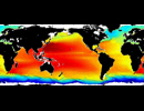
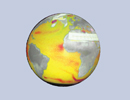
SeaWIF monthly climatology of chlorophyll concentration
Data from Sea-viewing Wide Field-of-view Sensor flown on OrbView2 polar
satellite are used to derive sea chlorophyll concentration. Original data are acquired from Goddard DAAC.
Monthly climatologies were constructed from daily 9km maps from Jan 2003 to Dec 2006 and averaged on a 0.25
degree lat/lon grid map.
IMPORTANT: Although the data are not copyrighted, their use is restricted to NASA authorized
research. For more details regarding use of the data refer to: http://oceancolor.gsfc.nasa.gov/SeaWiFS/ANNOUNCEMENTS/APPENDIX_B.html
Data become public domain five years after capture.
| Variables | chlorophyll concentration (mg/ cubic meter) |
| Zonal | Global by 0.25 deg |
| Meridional | Global by 0.25 deg |
| Vertical | |
| Temporal | Jan Climatology to Dec Climatology by 1 month(s) |
| Static? | yes |
| Volume | 50 Mb |
| Server | public:      |
| Source | http://oceancolor.gsfc.nasa.gov/REPROCESSING/SeaWiFS/R5.1/ |
| Acquired | March 2007 |
| APDRC contact | |
| Supplements |

