Aquarius Level 3 Sea Surface Salinity/Wind Speed Standard Mapped Image Monthly, Version 5.0 END-OF-MISSION DATA SET
This is the official NASA/Aquarius Project end-of-mission dataset spanning the complete 3-year, 9-month period of Aquarius science data availability, from August 25, 2011 through June 7, 2015 from the PO.DAAC.
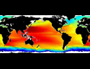
Data sets comprising this v5.0 release include Level 3 mapped salinity, wind speed, and derived density and spiciness products at 1 degree spatial resolution for ascending, descending and combined passes and for monthly time intervals. All users are strongly encouraged to work with V5.0 over any previous versions.
The Aquarius Data Users Guide, Aquarius Data Validation Document, and other primary technical documentation , are available from the FTP site together with reader software.
Note: The data is remotely accessed via the PO.DAAC's Thredds server.
| Variables |
Salinity (psu), Wind Speed (m/s) |
| Zonal | Global by 1.0 deg |
| Meridional | Global by 1.0 deg |
| Vertical | Surface |
| Temporal | Aug 2011 to Jun 2015 by 1 month |
| Static? | no |
| Volume | External |
| Server | public:      |
| Source | https://podaac.jpl.nasa.gov/aquarius |
| Acquired | February 28, 2013 (Updated Oct 2015) |
| APDRC contact | |
| Supplements | AquariusUserGuide_DatasetV5.0.pdf |

