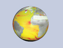
CARS2009
CSIRO Atlas of Regional Seas (CARS)
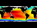
CARS is a digital climatology, or atlas of seasonal ocean water properties. It comprises gridded fields of mean ocean properties over the period of modern ocean measurement, and average seasonal cycles for that period. It is derived from a quality-controlled archive of all available historical subsurface ocean property measurements - primarily research vessel instrument profiles and autonomous profiling buoys. As data availability has enormously increased in recent years, the CARS mean values are inevitably biased towards the recent ocean state.
A number of global ocean climatologies are presently available, such as NODC's World Ocean Atlas. CARS is different as it employs extra stages of in-house quality control of input data, and uses an adaptive-lengthscale loess mapper to maximise resolution in data-rich regions, and the mapper's "BAR" algorithm takes account of topographic barriers. The result is excellent definition of oceanic structures and accuracy of point values.
CARS2009
CARS2009 covers the full global oceans on a 1/2 degree grid, but until June 2011 only included temperature and salinity fields. The T and S fields were created in July 2009 and were was based on World Ocean Database 2005 (WOD05) [July 2008 Update], surface-pressure-corrected Argo global archives to May 2009, WOCE Global Hydrographic Program (v3.0), and many other datasets available up to 2008. The nutrient fields created in June 2011 were based on WOCE and WOD09 (March 2011 download).
Argo-only
An alternative version of CARS is produced every few months which uses only Argo data. All available Argo data is used (both Real-Time and Delayed-Mode) and it is subjected to extra local screening before use.
Information for a given year
CARS does not provide information for any given year. CARS is created by averaging/interpolating all available oceanographic profile data, most of which was collected in the last 50 years. Especially when trying to provide an estimate at every location and every depth in the world's oceans, there is not enough data to resolve any one year, so we ignore the year of collection of each observation and retain only the day-of-year - and then fit a mean and mean-seasonal-cycle at each point.
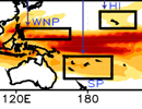
In the Western Equatorial Pacific and the Gulf of Carpentaria we apply corrections for interannual signals, but in general any such signals will effect the maps, both by these signals being aliased into spatial structure or seasonal cycles, and by biasing towards the interannual anomaly of data-rich periods.
Density inversions
Many CARS T-S profiles are not dynamically stable. Two of many reasons for this are that input data is often not stable (and not all T and S points come from the same measured profile), and each depth level is mapped essentially independantly of every other.
The CARS T and S mean fields could be adjusted so that every vertical profile is stable. Further, CARS could be adjusted so that any computed seasonal profile is stable. However, the stabilization routines available may not be suitable for every season in every water body. They may adjust the wrong parts of the profiles, or adjust S instead of T or vise versa. They may adjust well mapped values to accommodate poorly gap-filled sub-bottom values, or high variability surface waters.
Adjustment so that all seasonal profiles are stable requires the choice of whether to achieve this by allowing adjustment of the mean or not. If adjust the mean, then may introduce errors from poor seasonal harmonics. If do not adjust the mean then can only stabilize by reducing the magnitude of seasonal cycles, which we have taken great efforts to obtain at realistic magnitudes.
CARS is as computed by the loess smoother. We leave it to the user to apply dynamic stabilisation as required (and the distribution of modifications required is itself informative to the user.) One method is described in "A Conserved Minimal Adjustment Scheme for Stabilization of Hydrographic Profiles", Peter C. Chu and Chenwu Fan, JAOT, 2010. If stable seasonal profiles are required it may be preferable to first evaluate the profiles then stabilize, rather than adjusting the CARS seasonal harmonics.
T inversions
Temperature inversions occur in many parts of the world oceans, but are not observed within some depth bands in many other regions. Temperature as mapped by the CARS methods has inversions in the mean field where they are not known to occur naturally, and many more inversions in seasonal computed values. We have created a database describing broadly where T inversions are not observed in the worlds oceans and modified mean and seasonal harmonics so that inversions in computed seasonal profiles are minimised.
Conditions
The User acknowledges that the Product was developed by CSIRO for its own research purposes. The CSIRO will not therefore be liable for interpretation of or inconsistencies, discrepancies, errors or omissions in any or all of the Product as supplied.
Any use of or reliance by the User on the Product or any part thereof is at the User's own risk and CSIRO shall not be liable for any loss or damage howsoever arising as a result of such use.
The User agrees that whenever the Product or imagery/data derived from the Product are published by the User, the CSIRO Marine Laboratories shall be acknowledged as the source of the Product.
The User agrees to indemnify and hold harmless CSIRO in respect of any loss or damage (including any rights arising from negligence or infringement of third party intellectual property rights) suffered by CSIRO as a result of User's use of or reliance on the Data.
References
Ridgway K.R., J.R. Dunn, and J.L. Wilkin, Ocean interpolation by four-dimensional least squares -Application to the waters around Australia, J. Atmos. Ocean. Tech., Vol 19, No 9, 1357-1375, 2002
Dunn J.R., and K.R. Ridgway, Mapping ocean properties in regions of complex topography, Deep Sea Research I : Oceanographic Research, 49 (3) (2002) pp. 591-604
Scott A. Condie and Jeff R. Dunn (2006) Seasonal characteristics of the surface mixed layer in the Australasian region: implications for primary production regimes and biogeography. Marine and Freshwater Research, 2006, 57, 1-22.
| Variables | Dynamic Height Rel 2000m [m] (CARS2009, Argo-only) Mixed Layer Depth [m] (CARS2009, Argo-only) Temperature [DegC] (CARS2009, Bottom water, Argo-only) Salinity [PSU] (CARS2009, Bottom water, Argo-only) oxygen [ml/l] (CARS2009, Bottom water) nitrate [umol/l] (CARS2009,Bottom water) phosphate [umol/l] (CARS2009, Bottom water) silicate [umol/l] (CARS2009, Bottom water) |
| Zonal | Global by 0.5 deg |
| Meridional | 75S to 90N by 0.5 deg |
| Vertical | 0, 5, 10, 20, 30, 40, 50, 60, 70, 75, 80, 90, 100, 110, 120, 125, 130, 140, 150, 160, 170, 175, 180, 190, 200, 210, 220, 225, 230, 240, 250, 260, 270, 275, 280, 290, 300, 325, 350, 375, 400, 425, 450, 475, 500, 550, 600, 650, 700, 750, 800, 850, 900, 950, 1000, 1100, 1200, 1300, 1400, 1500, 1600, 1700, 1750, 1800, 1900, 2000, 2250, 2500, 2750, 3000, 3250, 3500, 3750, 4000, 4250, 4500, 4750, 5000, 5500 |
| Temporal | N/A |
| Static? | yes |
| Volume | 2.5 GB |
| Server | public:      |
| Source | http://www.marine.csiro.au/~dunn/cars2009/ |
| Acquired | Oct 4, 2017 |
| APDRC contact | |
| Supplements |

