NCEP Global Ocean Data Assimilation System (GODAS) - Pentad
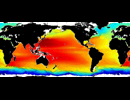
The operational data sets produced routinely by the Global Ocean Data Assimilation System (GODAS) developed at National Centers for Environmental Prediction (NCEP) are a valuable community asset for monitoring different aspects of ocean climate variability and assessing benefits of NOAA´s extensive investment in global ocean observing program.
The new Global Ocean Data Assimilation System (GODAS) was developed to be the replacement for RA6, and to provide oceanic initial conditions for the global Climate Forecast System (CFS) newly developed at NCEP (Saha et al. 2006). A simple evaluation of GODAS is reported by Behringer and Xue (2004), and a journal paper is in preparation. The GODAS is based on a quasi-global configuration of the GFDL MOM.v3. The model domain extends from 75°S to 65°N and has a resolution of 1° by 1° enhanced to 1/3° in the N-S direction within 10° of the equator. The model has 40 levels with a 10 meter resolution in the upper 200 meters. Please check the horizontal grid and vertical levels used for each field. The horizontal grid for the u- and v- velocity components is offset from the grid for the other fields. Additionally, the vertical grid for the vertical velocity is offset from the other subsurface fields. This configuration represents a small improvement over RA6 which had a 1.5° resolution in the E-W direction and 28 levels in the vertical. Other new features include an explicit free surface, the Gent-McWilliams isoneutral mixing scheme and the KPP vertical mixing scheme. The GODAS is forced by the momentum flux, heat flux, and fresh water flux from the NCEP atmospheric Reanalysis 2 (R2). In addition the temperature in the top model level is relaxed to weekly analyses of sea surface temperature, while the surface salinity is relaxed to annual salinity climatology.
Please note: This GODAS data product was obtained from PSD and they ask that you acknowledge them in your use of the data. This may be done by including text such as GODAS data provided by the NOAA/OAR/ESRL PSD, Boulder, Colorado, USA, from their Web site at http://www.esrl.noaa.gov/psd/ in any documents or publications using these data. They would also appreciate receiving a copy of the relevant publications. This will help PSD to justify keeping the GODAS data set freely available online in the future. Thank you!
References:
- Behringer, D.W., M. Ji, and A. Leetmaa, 1998: An improved coupled model for ENSO prediction and implications for ocean initialization. Part I: The ocean data assimilation system. Mon. Wea. Rev., 126, 1013-1021.
- Behringer, D.W., and Y. Xue, 2004: Evaluation of the global ocean data assimilation system at NCEP: The Pacific Ocean. Eighth Symposium on Integrated Observing and Assimilation Systems for Atmosphere, Oceans, and Land Surface, AMS 84th Annual Meeting, Washington State Convention and Trade Center, Seattle, Washington, 11-15.
- Derber, J.C., and A. Rosati, 1989: A global oceanic data assimilation system. J. Phys. Oceanogr., 19, 1333-1347.
- Ji, M., A. Leetmaa, and J. Derber, 1995: An ocean analysis system for seasonal to interannual climate studies. Mon. Wea. Rev., 123, 460-481.
- S. Saha, S. Nadiga, C. Thiaw, J. Wang, W. Wang, Q. Zhang, H. M. van den Dool, H.-L. Pan, S. Moorthi, D. Behringer, D. Stokes, M. Pe ña, S. Lord, G. White, W. Ebisuzaki, P. Peng, P. Xie , 2006 : The NCEP Climate Forecast System. Accepted J. Climate.
GODAS contacts: Yan Xue (Yan.Xue@noaa.gov) or David Behringer (David.Behringer@noaa.gov) or Boyin Huang (Boyin.Huang@noaa.gov)
| Variables |
bottom ocean mixed layer Geometric Depth Below Sea Surface [m]. bottom ocean isothermal layer Geometric Depth Below Sea Surface [m], Potential temp. [K]. Salinity [kg/kg], surface Salt flux [g/cm^2/s], surface Sea Surface Height Relative to Geoid [m], surface Total downward heat flux at surface [W/m^2], surface Zonal momentum flux [N/m^2], u of current [m/s], surface Meridional momentum flux [N/m^2], v of current [m/s], Geometric vertical velocity [m/s]
|
| Zonal | Global by 1 deg |
| Meridional | 75S to 65N by 0.33 deg Note: The horizontal grid for the u- and v- velocity components is offset from the grid for the other fields. |
| Vertical | surface - 4736m Note: The vertical grid for the vertical velocity is offset from the other subsurface fields. |
| Temporal | Jan 5, 1980 to Mar 31, 2024 by 5 day(s) |
| Static? | no |
| Volume | 2.8GB / year |
| Server | public:      |
| Source | http://www.cpc.ncep.noaa.gov/products/GODAS/ |
| Acquired | Sep 25, 2013 (Updated Apr 2024) |
| APDRC contact | |
| Supplements | http://www.cpc.ncep.noaa.gov/products/GODAS/background.shtml |

